If you’ve ever used Google Maps, you’ve likely come across 360-degree photos or “Street View.” These immersive photos allow you to explore a location as if you were actually there. But have you ever wondered how Google Maps captures these images? The answer lies in 360-degree cameras.
360-degree cameras, also known as omnidirectional cameras, capture a complete spherical view of the world around them. They use multiple lenses to capture images in all directions, which are then stitched together to create a seamless panoramic image. Google Maps uses these cameras to capture Street View images, allowing users to virtually explore locations all over the world.
But how does Google Maps use these images? In addition to providing a more immersive experience for users, Street View images are also used for mapping and navigation purposes. For example, Google Maps can use Street View images to help users navigate unfamiliar areas, or to provide more detailed information about a location. Understanding how 360-degree cameras work is key to understanding the technology behind Google Maps’ Street View feature.
Key Takeaways
- 360-degree cameras capture a complete spherical view of the world around them, allowing for immersive panoramic images.
- Google Maps uses these cameras to capture Street View images, which can be used for mapping and navigation purposes.
- Understanding how 360-degree cameras work is key to understanding the technology behind Google Maps’ Street View feature.
History of 360 Degree Cameras in Mapping
https://www.youtube.com/watch?v=oApM0jBRKbY&embed=true
Evolution of Street View Technology
Google Maps has been an essential tool for navigating the world around us. With the help of 360-degree cameras, Google Maps has been able to provide an immersive experience of the places we want to visit. The idea of 360-degree cameras for mapping was first introduced in 2007 when Google launched Street View. Initially, Street View used cameras mounted on vehicles to capture images of streets and buildings.
In 2009, Google introduced the Street View trike, a three-wheeled bicycle with a camera mounted on top, to capture images of places that were not accessible by car. After the trike, Google launched the Street View trolley, which could capture images of indoor locations such as museums and galleries.
Integration with Google Maps
Google Maps has become an indispensable tool for people all around the world. With the integration of 360-degree cameras, Google Maps has become even more useful. Google Maps has integrated with 360-degree cameras to enable users to create their own Street View.
You can publish your own Street View with a compatible 360 camera. Google Maps provides a list of compatible cameras that meet the minimum Google Maps 360 publishing criteria. Street View Ready products do not need special approval from Google to use the Street View Publish API. Street View Ready Pro is for Street View-compatible 360 cameras tailored for in-motion recording with a high degree of accuracy and image quality.
In conclusion, 360-degree cameras have revolutionized the way we explore the world. With the help of these cameras, Google Maps has become an immersive experience that allows us to explore places we have never been before.
Understanding 360 Degree Cameras
https://www.youtube.com/watch?v=xqWkJJOcU4g&embed=true
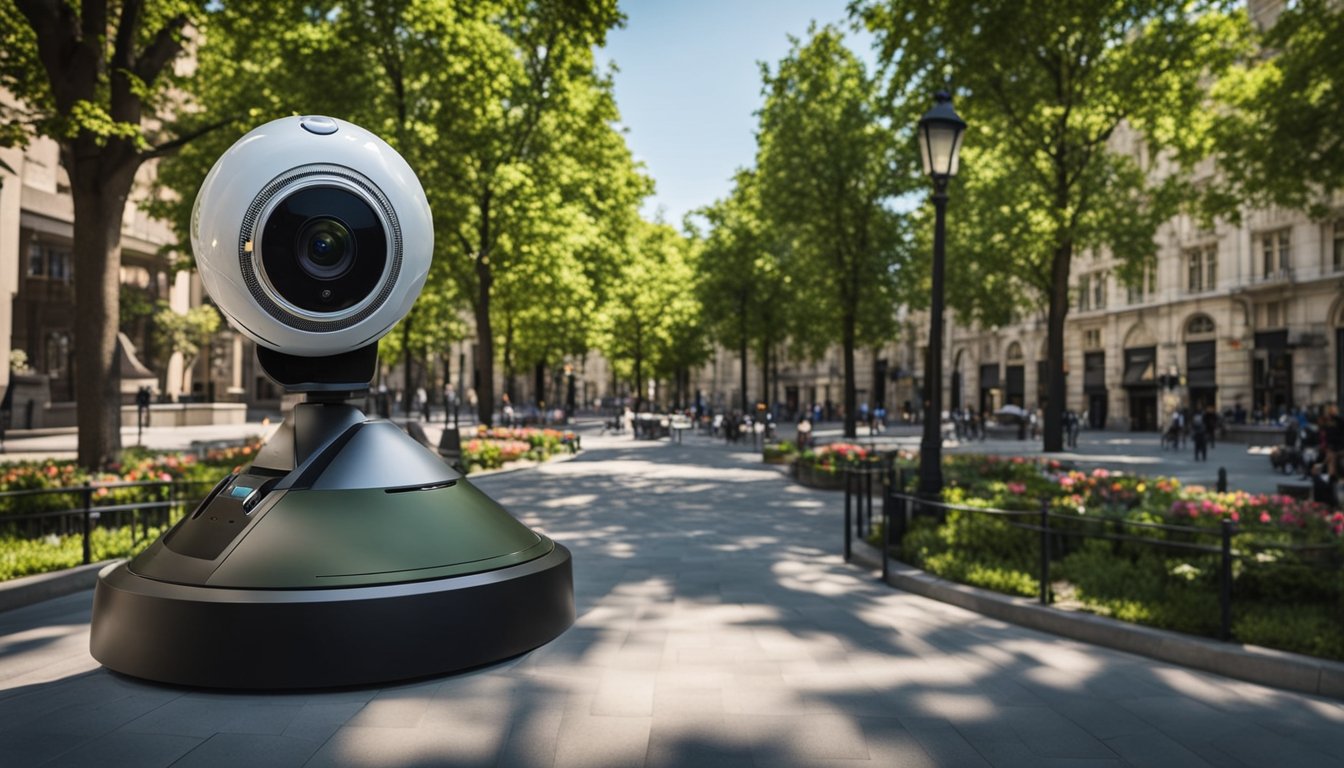
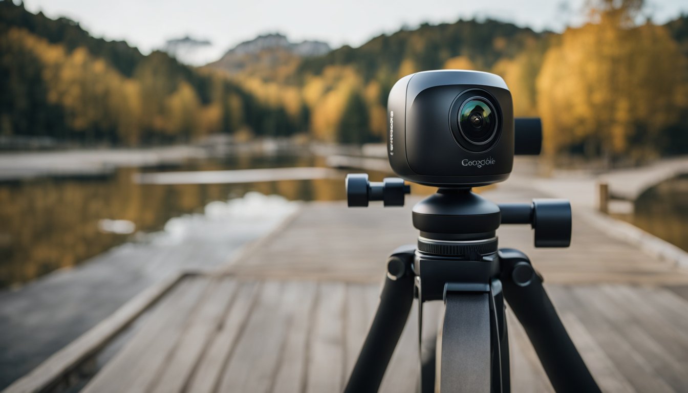
If you’re interested in contributing to Google Maps Street View, you’ll need to use a 360-degree camera. These cameras have lenses that capture a 360-degree view of the surrounding environment, which can then be stitched together to create a panoramic image. In this section, we’ll take a closer look at the types of 360 cameras and how they capture panoramic images.
Types of 360 Cameras
There are two main types of 360-degree cameras: single-lens and dual-lens. Single-lens cameras have one lens that captures a full 360-degree view. Dual-lens cameras have two lenses that capture two separate 180-degree views, which are then stitched together to create a full 360-degree view.
« When Did 360 Cameras Come Out? A Brief History of 360 Photography
How much does it cost to install a 360 camera in your car? »
Single-lens cameras are simpler to use and tend to be more affordable than dual-lens cameras. However, dual-lens cameras tend to produce higher-quality images with better stitching.


How They Capture Panoramic Images
360-degree cameras capture panoramic images by using multiple lenses to capture a full view of the surrounding environment. These images can be captured in either photo or video format.
When taking a 360-degree photo, the camera captures multiple images from different angles, which are then stitched together to create a single panoramic image. When taking a 360-degree video, the camera captures a continuous stream of images that are then stitched together to create a seamless video.
Some 360-degree cameras also come with built-in software that can stitch the images together automatically. Others require you to use third-party software to stitch the images together.
Overall, 360-degree cameras are a great way to capture panoramic images for Google Maps Street View. Whether you choose a single-lens or dual-lens camera, make sure to follow the guidelines provided by Google to ensure that your images are high-quality and contribute to the Google Maps community.
The Role of Google Maps in Utilizing 360 Degree Cameras
https://www.youtube.com/watch?v=IwWHhbBzqfc&embed=true


Google Maps is a popular navigation app that allows users to explore the world from their device. One of the key features of Google Maps is the Street View feature, which provides users with a 360-degree view of streets, buildings, and landmarks. Google Maps achieves this by utilizing 360-degree cameras.
Street View Feature
The Street View feature on Google Maps allows users to explore cities and towns from a street-level perspective. This feature is made possible by the use of 360-degree cameras, which capture images from all angles. These images are then stitched together to create a seamless 360-degree view.
Google has its own proprietary 360-degree camera, called the Trekker, which is used to capture images for the Street View feature. The Trekker is a backpack-mounted camera that allows Google to capture images in areas that are not accessible by car, such as hiking trails and narrow streets.
User Contributions
Google Maps also allows users to contribute their own 360-degree images to the Street View feature. Users can do this by using a compatible 360-degree camera and uploading their images to Google Maps. This allows users to share their own experiences and perspectives with others.
Google Maps does not certify any operational or mechanical functions of the 360-degree cameras used by users. If you have any specific technical or logistical issues, address them directly with the supplier.
In conclusion, Google Maps has revolutionized the way we explore the world. The Street View feature, made possible by the use of 360-degree cameras, allows us to explore cities and towns from a street-level perspective. Additionally, user contributions to the Street View feature allow us to share our own experiences and perspectives with others.
Hardware Behind Google Maps’ 360 Cameras
https://www.youtube.com/watch?v=Xt07_4YhIwA&embed=true
Google Maps’ 360-degree cameras are responsible for capturing the panoramic views that are available on the platform. These cameras are equipped with advanced technology that allows them to capture high-quality images, which are then stitched together to create a seamless panoramic view. In this section, we will take a look at the hardware specifications of these cameras and how they are mounted and moved around to capture panoramic views.
Camera Specifications
Google Maps’ 360-degree cameras are equipped with high-resolution sensors that capture images in all directions. These sensors are capable of capturing images at resolutions of up to 15 megapixels, which results in high-quality panoramic images. The cameras are also equipped with advanced optics that ensure that the images captured are sharp and clear.
The cameras are designed to capture images in all lighting conditions, including low light and bright sunlight. They are also equipped with advanced image stabilization technology that ensures that the images captured are not blurry or distorted. The cameras are powered by high-capacity batteries that allow them to capture images for extended periods without needing to be recharged.
Mounting and Mobility
Google Maps’ 360-degree cameras are mounted on a specialized rig that allows them to capture images from all directions. The rig is mounted on a vehicle, which is driven around to capture panoramic views of different locations. The rig is designed to be lightweight and compact, which makes it easy to move around and mount on different vehicles.
The rig is also equipped with GPS technology, which allows Google Maps to accurately map the location of the panoramic images captured. This technology ensures that the panoramic images are accurately placed on the map, which makes it easy for users to find them.
In conclusion, Google Maps’ 360-degree cameras are equipped with advanced technology that allows them to capture high-quality panoramic images. The cameras are mounted on a specialized rig that is designed to be lightweight and compact, which makes it easy to move around and mount on different vehicles. The cameras are also equipped with GPS technology, which ensures that the panoramic images are accurately placed on the map.
Software that Powers 360 Degree Photography
When you take a 360-degree photo using a compatible camera, the software behind Google Maps takes care of the rest. The software uses a combination of image stitching algorithms and data processing to create a seamless, immersive experience for viewers.
Image Stitching Algorithms
The first step in creating a 360-degree photo is to stitch together the individual images captured by the camera. This is done using sophisticated image stitching algorithms that analyze each image and find common points to align them. These algorithms use complex mathematical calculations to create a seamless, distortion-free image.
Data Processing
Once the images have been stitched together, the software uses data processing techniques to add additional information to the image. This includes geographic information, such as the location of the photo, as well as metadata about the camera used to capture the image.
The software also uses machine learning algorithms to identify objects in the image, such as buildings and landmarks. This information is then used to create a 3D model of the environment, which allows viewers to move around and explore the scene in a more immersive way.
Overall, the software that powers 360-degree photography in Google Maps is a complex and sophisticated system that combines cutting-edge image stitching algorithms with advanced data processing techniques. By using a compatible camera and following the guidelines provided by Google, you can create your own immersive 360-degree photos and share them with the world.
Data Collection and Privacy
https://www.youtube.com/watch?v=E2IZadLlCtE&embed=true
When using Google Maps, it is important to understand how data collection and privacy policies work. Google Maps uses 360-degree cameras to capture images of streets and public places, which are then used to create Street View. This technology allows users to see detailed images of locations around the world, but it also raises concerns about privacy.
Blurring Faces and License Plates
To address privacy concerns, Google has implemented a blurring feature that automatically blurs faces and license plates in Street View images. This feature helps to protect the privacy of individuals who may be captured in the images.
Google uses automated technology to detect and blur faces and license plates, but it is not perfect. If you notice an image that has not been blurred, you can report it to Google for review. Google will then determine if the image needs to be blurred.
Data Usage Policies
Google Maps collects a variety of data in addition to images, including location data, search history, and device information. This data is used to provide users with personalized recommendations and to improve the overall Google Maps experience.
Google Maps also allows users to contribute to the platform by adding reviews, photos, and other content. When you contribute content to Google Maps, you retain ownership of that content, but you grant Google a license to use, display, and distribute that content.
To protect user privacy, Google has implemented a number of data usage policies. For example, Google will only share location data with third-party apps with the user’s consent. Additionally, Google will not sell user data to third parties.
Overall, Google Maps is a powerful tool for exploring the world, but it is important to understand how data collection and privacy policies work. By taking advantage of the blurring feature and understanding data usage policies, you can use Google Maps with confidence.
Practical Applications of 360 Degree Views
https://www.youtube.com/watch?v=3g3NoY5B0wM&embed=true
360-degree views have been revolutionizing the way we navigate and explore the world around us. With the help of 360-degree cameras, we can capture and share immersive visuals of different locations. Google Maps is one of the most popular platforms that utilize 360-degree views to provide a more realistic and interactive experience. Here are some practical applications of 360-degree views that you can explore with Google Maps.
Navigation and Exploration
Google Maps’ 360-degree views allow you to virtually explore a location before actually visiting it. This is particularly useful when you’re planning a trip to a new place or trying to find your way around an unfamiliar city. With the help of 360-degree views, you can get a better sense of the layout of the area, landmarks, and other points of interest. You can also use 360-degree views to get a better understanding of the traffic conditions and road networks of a particular area.
Business and Real Estate
360-degree views can also be beneficial for businesses and real estate agents. By capturing and sharing immersive visuals of their properties, businesses and real estate agents can provide a more engaging and interactive experience to their customers. This can help them attract more customers and increase sales. For example, a restaurant can use 360-degree views to showcase its ambiance and menu, while a real estate agent can use it to showcase the interior and exterior of a property.
Overall, 360-degree views have numerous practical applications, from navigation and exploration to business and real estate. With the help of Google Maps and 360-degree cameras, you can experience these practical applications for yourself and explore the world in new and exciting ways.
User Interaction with 360 Degree Views
https://www.youtube.com/watch?v=SLAYD6fnDUM&embed=true
Google Maps allows users to interact with 360-degree views in two main ways: navigating virtual tours and contributing to Street View.
Navigating Virtual Tours
When viewing a location on Google Maps that has a 360-degree view available, you can click on the image to enter a virtual tour. Once you are in the virtual tour, you can use your mouse or finger to navigate around the space. You can also use the on-screen controls to move forward, backward, and turn left or right.
If you are using a device with a gyroscope, such as a smartphone or tablet, you can also move your device around to look around the space as if you were actually there. This feature provides a more immersive experience and allows you to explore the space in a more natural way.
Contributing to Street View
Google Maps allows users to contribute to the Street View feature by submitting their own 360-degree photos. To do so, you need a compatible 360-degree camera, which you can choose from a list of recommended cameras provided by Google. Once you have taken your photos, you can upload them to Google Maps using the Street View app or a web browser.
Contributing to Street View is a great way to share your experiences and help others explore new places. It also allows you to contribute to the accuracy and completeness of the Google Maps database.
Overall, interacting with 360-degree views on Google Maps is a fun and engaging way to explore the world around you. Whether you are navigating virtual tours or contributing to Street View, there are many ways to get involved and make the most of this exciting feature.
Challenges in 360 Degree Imaging
Capturing 360-degree images is a complex process that involves overcoming several technical and environmental challenges. In this section, we will discuss some of the common challenges faced when capturing 360-degree images for Google Maps.
Technical Limitations
One of the biggest challenges in 360-degree imaging is dealing with technical limitations. The camera used to capture 360-degree images must be capable of capturing high-quality images in all directions. This requires specialized lenses and sensors that can capture images with high dynamic range and resolution.
Another technical limitation is the need to stitch together multiple images to create a seamless 360-degree panorama. This process can be time-consuming and requires specialized software that can accurately align and blend images. Even with the best software, there can be issues with stitching errors that result in visible seams or distortions in the final image.
Environmental Factors
In addition to technical limitations, there are also environmental factors that can impact the quality of 360-degree images. For example, changes in lighting conditions can affect the exposure and color balance of the images. This can be particularly challenging when capturing images outdoors, where the lighting conditions can change rapidly.
Other environmental factors that can impact the quality of 360-degree images include weather conditions, such as rain or snow, and obstructions, such as trees or buildings. These factors can make it difficult to capture images that are free from visual distractions or distortions.
Despite these challenges, Google Maps has made it possible for anyone to contribute 360-degree images to their platform. With the right equipment and techniques, it’s possible to capture stunning 360-degree images that provide a unique perspective on the world around us.
Future of 360 Degree Cameras in Mapping
https://www.youtube.com/watch?v=qExPe-nKdfI&embed=true
As technology continues to evolve, 360-degree cameras are becoming increasingly popular in mapping. Google Maps, for example, has been using 360-degree cameras to capture street views for years now. But what does the future hold for 360-degree cameras in mapping? In this section, we’ll explore some potential technological advancements and new features that could be added to 360-degree cameras in the future.
Technological Advancements
One potential area for improvement in 360-degree cameras is image quality. As cameras become more advanced, we can expect to see higher resolution images and improved color accuracy. This will allow for more detailed street views and better navigation for users.
Another area for improvement is low-light technology. Currently, 360-degree cameras struggle in low-light conditions, which can make it difficult to capture accurate street views. However, as technology improves, we can expect to see cameras that are better equipped to handle low-light conditions, resulting in more accurate and detailed street views.
Potential New Features
In addition to technological advancements, there are also several potential new features that could be added to 360-degree cameras in the future. For example, cameras could be equipped with sensors that detect and capture smells, allowing users to “smell” their way through a city. Additionally, cameras could be equipped with microphones that capture ambient noise, providing users with an immersive audio experience.
Another potential new feature is the ability to capture 3D images. This would allow users to view street views in 3D, providing a more immersive experience. Additionally, cameras could be equipped with augmented reality technology, allowing users to view virtual objects overlaid onto real-world environments.
Overall, the future of 360-degree cameras in mapping is bright. As technology continues to improve, we can expect to see cameras that are better equipped to capture accurate and detailed street views, as well as new features that provide users with a more immersive experience.
Getting Started with Google Maps and 360 Degree Cameras
https://www.youtube.com/watch?v=EOQn41nHDm4&embed=true
If you’re interested in creating your own Street View imagery for Google Maps, you’ll need a compatible 360-degree camera. Here’s a quick guide on how to get started.
Setting Up Your Camera
Before you start capturing 360-degree imagery, you’ll need to ensure that your camera is set up correctly. Check the manufacturer’s instructions to ensure that your camera is charged, and that you have the correct memory card installed. You’ll also need to ensure that your camera is compatible with the Street View app, which you can download from the App Store or Google Play.
Creating Your First 360 View
Once your camera is set up, you can start capturing your first 360-degree view. Open the Street View app, and select the “Camera” option. Follow the on-screen instructions to capture your first 360-degree image. You can then use the app to upload your imagery to Google Maps.
When you upload your imagery to Google Maps, it’s important to ensure that your imagery is of high quality. Google doesn’t certify any operational or mechanical functions of your camera, so it’s up to you to ensure that your imagery is of the highest quality possible. You can find tips for capturing 360-degree videos for Street View on the Google Maps Help page.
In conclusion, getting started with Google Maps and a 360-degree camera is easy and straightforward. Just ensure that your camera is set up correctly, and that you capture high-quality imagery. With the Street View app, you can create your own Street View imagery and share it with the world.
Frequently Asked Questions
https://www.youtube.com/watch?v=HV46i7xUNXg&embed=true
How does Google capture Street View images with a 360-degree perspective?
Google captures Street View images with a 360-degree perspective using special cameras that take multiple photos as they rotate. These photos are then stitched together to create a seamless panoramic image. Google’s Street View cars, bikes, and backpacks are all equipped with these cameras to capture images from different perspectives.
What type of camera does Google use for Street View photography?
Google uses a variety of cameras for Street View photography, including the Insta360 Pro2, the GoPro Fusion, and the Ricoh Theta. These cameras are designed to capture high-quality 360-degree images and are compatible with Google’s Street View publishing platform.
Can individuals contribute 360-degree images to Google Maps, and if so, how?
Yes, individuals can contribute 360-degree images to Google Maps through the Street View app or through the Google Maps website. To contribute, you will need a 360-degree camera and a Google account. Simply upload your images to the Street View app or website, and they will be reviewed and published by Google if they meet the necessary quality standards.
How often does Google update their Street View imagery?
Google updates their Street View imagery on a regular basis, but the frequency of updates can vary depending on the location. Some areas may be updated every few months, while others may only be updated once every few years.
What’s the process for accessing the 360-degree Street View mode on Google Maps?
To access the 360-degree Street View mode on Google Maps, simply search for a location and then click on the Street View button. You can then use your mouse or touch screen to navigate the 360-degree image and explore the surrounding area.
Are there any specific 360 cameras recommended for creating content for Google Street View?
While Google does not endorse any specific 360 cameras for Street View photography, they do provide a list of recommended cameras on their website. Some popular options include the Insta360 Pro2, the GoPro Fusion, and the Ricoh Theta. It’s important to choose a camera that is compatible with Google’s Street View publishing platform and meets their quality standards.