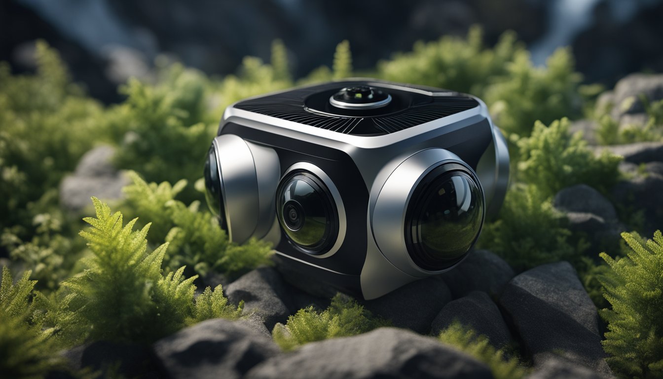
360 cameras with lidar are becoming increasingly popular in a variety of industries, including surveying, construction, and virtual reality. These cameras use light detection and ranging (lidar) technology to capture precise measurements of an environment, allowing for highly accurate 3D models and point clouds. The combination of 360-degree imaging and lidar technology is particularly useful in industries that require detailed spatial data.
One of the key features of lidar cameras is their ability to capture precise measurements of an environment, even in low light or difficult conditions. This makes them ideal for use in construction and surveying, where accuracy is crucial. In addition, the 360-degree imaging capabilities of these cameras make it possible to capture a complete picture of an environment, including hard-to-reach areas and details that might be missed with traditional surveying methods.
Key Takeaways
- 360 cameras with lidar use light detection and ranging technology to capture highly accurate 3D models and point clouds.
- These cameras are particularly useful in industries that require detailed spatial data, such as construction and surveying.
- The combination of 360-degree imaging and lidar technology allows for a complete picture of an environment, including hard-to-reach areas and details that might be missed with traditional surveying methods.
Overview of 360 Cameras with Lidar
If you are looking for a 360 camera that can capture high-quality images and videos with accurate depth perception, then a 360 camera with Lidar is the perfect solution for you. These cameras use Lidar technology to create a 3D map of the environment, which helps to create highly accurate and detailed 360-degree images and videos.
One of the main benefits of using a 360 camera with Lidar is the improved image quality. The Lidar technology allows the camera to capture images with greater detail and accuracy, which results in a more realistic and immersive viewing experience. Additionally, the 360-degree field of view provides a complete view of the environment, which is ideal for capturing panoramic views of landscapes, cityscapes, and other outdoor scenes.
Another advantage of using a 360 camera with Lidar is the increased field of view. These cameras can capture a full 360-degree view of the environment, which allows you to capture more information in a single shot. This is especially useful for capturing large outdoor scenes, where it would be difficult to capture all the details with a traditional camera.
When it comes to video, 360 cameras with Lidar can capture high-quality footage with accurate depth perception. This is ideal for creating immersive virtual reality experiences, where viewers can explore the environment in 3D. Additionally, the Lidar technology helps to reduce distortion and other visual artifacts, which can result in a more realistic and enjoyable viewing experience.
In summary, if you are looking for a camera that can capture highly accurate and detailed 360-degree images and videos, then a 360 camera with Lidar is the perfect solution for you. With improved image quality, increased field of view, and accurate depth perception, these cameras are ideal for capturing immersive panoramic views of landscapes, cityscapes, and other outdoor scenes.
Key Features of Lidar Cameras
If you are looking for a camera that can provide you with high-resolution imaging, speed and efficiency, accuracy, and precision, then a 360 camera with Lidar is the perfect choice for you. Lidar cameras are equipped with a laser scanner that can capture a large number of data points in a very short amount of time. This data is then used to create a 3D point cloud, which can be used to create highly accurate and detailed maps of any environment.
High-Resolution Imaging
One of the key features of Lidar cameras is their ability to capture high-resolution images. The laser scanner used in these cameras can capture a large number of data points, which can be used to create highly detailed and accurate maps of any environment. This makes Lidar cameras perfect for applications such as surveying, mapping, and construction.
Speed and Efficiency
Another key feature of Lidar cameras is their speed and efficiency. The laser scanner used in these cameras can capture a large number of data points in a very short amount of time, which makes them ideal for applications that require fast and accurate data capture. This makes Lidar cameras perfect for applications such as autonomous vehicles, where speed and accuracy are essential.
Accuracy and Precision
Lidar cameras are also known for their accuracy and precision. The laser scanner used in these cameras can capture data points with a high degree of accuracy, which makes them ideal for applications that require precise measurements. This makes Lidar cameras perfect for applications such as surveying, mapping, and construction.
In conclusion, if you are looking for a camera that can provide you with high-resolution imaging, speed and efficiency, accuracy, and precision, then a 360 camera with Lidar is the perfect choice for you. With their laser scanner and point cloud technology, Lidar cameras are capable of capturing highly accurate and detailed maps of any environment.


Popular Models in the Market
« 360 Cameras vs DSLR Cameras: Choosing the Best for Your Photography Needs
Can You Add a 360 Camera to F150? Understanding Your Upgrade Options »
If you’re looking for a 360 camera with LiDAR, there are several popular models available in the market that you can choose from. Here are two of the most popular models:
Leica BLK360
Leica BLK360 is a popular 360 camera with LiDAR that offers high-definition and accurate environmental capture. The camera is a lightweight and compact device that can be easily carried around. It has a range of up to 60 meters and can capture 360-degree images in less than 3 minutes. The camera also comes with a built-in thermal sensor that allows you to capture thermal images of the environment.
Matterport Cameras
Matterport Cameras are another popular option if you’re looking for a 360 camera with LiDAR. The company offers two models – BLK360 G1 and Leica BLK360 G1. Both cameras are designed for high-definition and accurate environmental capture. The BLK360 G1 is a lightweight and compact device that can be easily carried around. It has a range of up to 60 meters and can capture 360-degree images in less than 3 minutes. The Leica BLK360 G1 is a more advanced model that comes with a built-in thermal sensor and a range of up to 80 meters.
Overall, when it comes to choosing a 360 camera with LiDAR, it’s important to consider your specific needs and preferences. Both Leica BLK360 and Matterport Cameras are popular models that offer high-quality and accurate environmental capture.
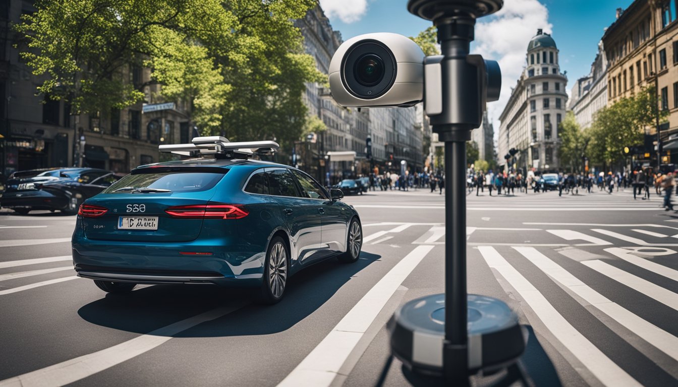
Applications in Surveying and Construction
360-degree camera with LiDAR technology is a game-changer in the surveying and construction industries. It provides accurate data that can be used for various purposes, including site documentation and digital twin creation.


Site Documentation
360 cameras with LiDAR technology can be used to capture detailed site documentation. This documentation can be used to create 3D models of job sites. The 3D models can be used to identify potential issues and develop plans to address them. Additionally, the documentation can be used to create as-built documentation that can be used in the future for maintenance and repair work.
Digital Twin Creation
360 cameras with LiDAR technology can also be used to create digital twins of job sites. Digital twins are virtual replicas of physical assets. They can be used to monitor the performance of assets and identify potential issues before they become major problems. Digital twins can also be used to optimize the performance of assets and reduce downtime.
LiDAR technology is also useful in Building Information Modeling (BIM). BIM is a digital representation of the physical and functional characteristics of a building. It is used to create 3D models of buildings that can be used for planning, design, construction, and operations. LiDAR technology can be used to capture accurate data that can be used to create BIM models.
In summary, 360 cameras with LiDAR technology are useful in surveying and construction. They can be used for site documentation, digital twin creation, and BIM. The accurate data provided by LiDAR technology can be used to identify potential issues, optimize performance, and reduce downtime.
Integration in AEC Industry
360 cameras with LiDAR integration have revolutionized the Architecture, Engineering, and Construction (AEC) industry. They have enabled the creation of accurate and detailed 3D models of buildings and infrastructure, which can be used for various purposes such as design, planning, and construction.
BIM Workflows
Building Information Modeling (BIM) workflows have been greatly enhanced by the use of 360 cameras with LiDAR integration. These cameras can capture detailed point cloud data of buildings and infrastructure, which can be used to create accurate 3D models for BIM workflows. This data can be used for clash detection, design validation, and construction planning.
Collaboration and Sharing
360 cameras with LiDAR integration have also made collaboration and sharing of data much easier in the AEC industry. The captured data can be easily shared with stakeholders such as architects, engineers, and contractors, allowing for better collaboration and communication. This can lead to a more streamlined and efficient construction process, as well as better quality control and project management.
In summary, the integration of 360 cameras with LiDAR technology has had a significant impact on the AEC industry. They have enabled more accurate and detailed data collection, enhanced BIM workflows, and improved collaboration and sharing of data.
Advancements in Imaging Technology
Lidar and Photogrammetry
In recent years, the combination of 360-degree cameras and Lidar technology has revolutionized the way we capture and process images. Lidar, which stands for Light Detection and Ranging, is an imaging laser scanner that can capture high-resolution 3D images of objects and environments even in low light conditions. It works by emitting laser pulses and measuring the time it takes for them to bounce back, creating a highly accurate and detailed point cloud of the scanned area.
When combined with photogrammetry, which is the science of making measurements from photographs, Lidar can create photorealistic digital twins of even complex environments, such as cities, forests, or construction sites. This allows for an almost real-time creation of both geo-referenced and photorealistic digital twins of even complex environments of a vehicle moving up to 100 km/hour. The result is a highly accurate and detailed 3D model that can be used for a wide range of applications, from urban planning and architecture to virtual reality and VFX.
VIS Technology
Another major advancement in imaging technology is the use of VIS (Visible Imaging Spectrometer) technology. VIS technology works by capturing images in multiple spectral bands, which can reveal hidden information about the object or environment being scanned. This can include information about the object’s chemical composition, temperature, or other physical properties.
One of the main advantages of VIS technology is its ability to capture images in both the visible and non-visible parts of the electromagnetic spectrum. This allows for highly accurate and detailed images of objects and environments that would otherwise be invisible to the naked eye. For example, VIS technology can be used to detect and map the spread of wildfires, monitor crop health, or detect leaks in pipelines.
In conclusion, advancements in imaging technology, such as Lidar and VIS technology, have revolutionized the way we capture and process images. These technologies offer highly accurate and detailed images of objects and environments that can be used for a wide range of applications, from urban planning and architecture to virtual reality and VFX.
Software and Data Management
When it comes to managing the data generated by 360 cameras with LiDAR, there are a few key things to keep in mind. In this section, we’ll cover the E57 file format and point cloud data processing.
E57 File Format
The E57 file format is a popular format for storing point cloud data. It is an open standard that was developed by ASTM International and is supported by a wide range of software tools and applications. E57 files are designed to be highly efficient and can store large amounts of data in a relatively small file size.
One of the benefits of using E57 files is that they can be easily shared between different software tools and applications. This makes it easy to work with point cloud data across different platforms and workflows. Additionally, E57 files can be compressed to further reduce file size and improve performance.
Point Cloud Data Processing
Once you have captured point cloud data with your 360 camera and LiDAR, you will need to process it using specialized software tools. There are a number of different software tools available for point cloud data processing, each with its own strengths and weaknesses.
Some popular software tools for point cloud data processing include Autodesk ReCap, FARO Scene, and Leica Cyclone. These tools are designed to help you process, edit, and analyze point cloud data in a variety of ways. They can also help you create detailed 3D models and visualizations from your point cloud data.
In addition to these software tools, there are also a number of open source libraries and frameworks available for point cloud data processing. These tools can be a great option if you are working on a tight budget or want to customize your point cloud data processing workflow.
Overall, managing and processing point cloud data from your 360 camera with LiDAR can be a complex task. However, with the right software ecosystem and tools, you can create detailed and accurate 3D models that can be used for a wide range of applications.
Operational Considerations
When choosing a 360 camera with LiDAR, there are some operational considerations to keep in mind. Here are some things to consider:
Battery and Power Management
One of the most important considerations when selecting a 360 camera with LiDAR is battery life and power management. Since these cameras require a lot of power to operate, you need to make sure that the battery can last long enough to complete your project. You may also want to consider purchasing additional batteries or a battery pack to extend the camera’s runtime. It is also important to manage the power consumption of the camera by turning off any unnecessary features or settings.
Device Portability
Another important consideration when selecting a 360 camera with LiDAR is portability. If you need to move around a lot while capturing images, a small and portable camera may be more suitable for your needs. Some cameras are designed to be more portable than others, so be sure to consider the size and weight of the camera before making a purchase. Additionally, some cameras may have features that make them easier to carry, such as a built-in handle or strap.
When selecting a 360 camera with LiDAR, it is important to consider the battery and power management capabilities of the camera, as well as its portability. By taking these factors into account, you can select a camera that meets your needs and allows you to capture high-quality 360-degree images.
Economic Aspects
Cost Analysis
When considering investing in a 360 camera with LiDAR, it is important to analyze the cost of the equipment. The price of a 360 camera with LiDAR can vary depending on the model and features. You can expect to pay anywhere from a few thousand dollars to tens of thousands of dollars for a high-end model. However, it is important to keep in mind that the cost of the equipment is just one aspect of the overall investment.
In addition to the cost of the equipment, you will also need to consider the cost of training your staff to use the equipment. This will ensure that your team is able to use the equipment effectively and get the most out of your investment. You may also need to hire additional staff to operate the equipment and manage the data.
Return on Investment
While the initial cost of a 360 camera with LiDAR may seem high, it is important to consider the potential return on investment. The use of this technology can improve accuracy and efficiency in a variety of industries, including construction, architecture, and surveying. By using a 360 camera with LiDAR, you can reduce the amount of time and resources needed to collect data and create accurate 3D models. This can lead to increased productivity and cost savings for your business.
For small businesses, the investment in a 360 camera with LiDAR may seem daunting. However, there are options available to make this technology more accessible. Some companies offer leasing or financing options to help spread out the cost over time. Additionally, there are more affordable models available that may be a better fit for smaller businesses.
Overall, the cost of a 360 camera with LiDAR may seem high, but the potential return on investment can make it a worthwhile investment for many businesses. By improving accuracy and efficiency, this technology can help businesses save time and money in the long run.
Creating Virtual Experiences
If you’re looking to create immersive virtual experiences, a 360 camera with LiDAR is an excellent tool to have. With this technology, you can capture spherical images that help you create virtual tours and other VR content. Here are some of the things you can do with a 360 camera with LiDAR.
Virtual Tours
One of the most popular uses for 360 cameras with LiDAR is to create virtual tours. This technology allows you to capture every angle of a space, from floor to ceiling and everything in between. You can then stitch these images together to create a virtual tour that allows your viewers to feel like they’re actually there.
This technology is particularly useful for businesses that want to showcase their properties. With a virtual tour, you can give potential customers a better sense of what your space looks like. You can also use virtual tours to create immersive experiences for your customers. For example, you can create a virtual tour of your restaurant or hotel that allows customers to explore your space before they visit.
VR Integration
360 cameras with LiDAR are also useful for creating VR content. You can use the images you capture to create immersive VR experiences that transport your viewers to a different location. This technology is particularly useful for creating VR content for Google Street View.
You can also use 360 cameras with LiDAR to create Matterpak. Matterpak is a collection of 3D data that allows you to create detailed models of a space. This technology is particularly useful for architects and designers who want to create accurate models of their designs.
In conclusion, 360 cameras with LiDAR are an excellent tool for creating immersive virtual experiences. Whether you’re creating virtual tours or VR content, this technology can help you create engaging content that transports your viewers to a different location.
Future Trends and Innovations
As technology continues to evolve, the future of 360 cameras with lidar is looking bright. Here are some emerging technologies and market evolution trends to keep an eye on.
Emerging Technologies
One of the most exciting emerging technologies in the field of 360 cameras with lidar is the use of hyperspectral and multispectral imaging. These technologies allow for the capture of images in a wide range of wavelengths, providing a more detailed and accurate view of the environment. This can be especially useful for applications like agriculture, where multispectral imaging can be used to detect crop health and identify areas that require attention.
Another emerging technology is the use of lidar-based cameras for augmented reality (AR) and virtual reality (VR) applications. These cameras can capture detailed 3D models of real-world environments, which can then be used to create immersive AR and VR experiences. This has the potential to revolutionize industries like gaming and entertainment, as well as education and training.
Market Evolution
As the market for 360 cameras with lidar continues to evolve, we can expect to see a number of new innovations and trends emerge. One of the most significant is the increasing use of these cameras in industrial and commercial applications. From construction and engineering to transportation and logistics, 360 cameras with lidar are becoming an essential tool for businesses looking to improve efficiency and accuracy.
Another trend to watch is the growing popularity of lidar cameras that are integrated with other sensors and technologies. For example, some cameras now come equipped with GPS and IMU sensors, allowing for more accurate positioning and orientation. Others are being integrated with machine learning algorithms, which can be used to analyze data and provide insights in real-time.
Overall, the future of 360 cameras with lidar looks bright. As technology continues to evolve and new innovations emerge, we can expect to see these cameras become even more powerful and versatile, with applications in a wide range of industries and fields.
Frequently Asked Questions
What are the best 360 cameras with LiDAR for 3D scanning?
There are several 360 cameras with LiDAR that are suitable for 3D scanning. Some of the popular options include the Insta360 Titan, the Kandao QooCam 8K, and the Z CAM V1 Pro. These cameras are designed to capture high-quality 360-degree images and videos with LiDAR technology for enhanced depth perception.
How much does a 3D LiDAR scanner typically cost?
The cost of a 3D LiDAR scanner varies depending on the brand, model, and features. Generally, a 3D LiDAR scanner can cost anywhere from a few hundred to tens of thousands of dollars. However, there are some affordable options available for those on a budget.
Can you use a LiDAR sensor with an Arduino for 360-degree scanning?
Yes, you can use a LiDAR sensor with an Arduino for 360-degree scanning. There are several LiDAR sensors available in the market that can be interfaced with an Arduino board. This allows you to create your own 360-degree scanning system without the need for expensive equipment.
What are the advantages of using LiDAR over traditional 3D cameras?
LiDAR offers several advantages over traditional 3D cameras. LiDAR technology can capture highly accurate 3D models with enhanced depth perception. This makes it ideal for applications such as 3D scanning, mapping, and surveying. LiDAR is also unaffected by lighting conditions, making it a more reliable option in low-light environments.
Are there affordable LiDAR scanner options recommended by the Reddit community?
Yes, there are several affordable LiDAR scanner options recommended by the Reddit community. Some of the popular options include the RPLidar A1M8, the Slamtec RPLIDAR A2, and the Benewake TFmini. These scanners offer high-quality performance at a fraction of the cost of more expensive models.
Which smartphones come equipped with a LiDAR camera?
Currently, the iPhone 12 Pro and the iPhone 12 Pro Max are the only smartphones that come equipped with a LiDAR camera. The LiDAR camera on these devices can be used for various applications such as augmented reality, 3D scanning, and more.